
Country quiz · The Americas
Guatemala quiz
Guatemala comes up in 6 quizzes: 3 Explorer photos, flag, outline, 2 trivia questions and the Americas map. Antigua and Tikal are among its 3 photos.
★ 4.7 on Google Play· 60 ratings· 1000+ downloads· Free
8 questions about Guatemala only, mixed from every pack it appears in. Scored on the spot.
Guatemala at a glance
| Capital | Guatemala City |
|---|---|
| Continent | The Americas |
| Location | Central America, bordering the North Pacific Ocean, between El Salvador and Mexico, and bordering the Gulf of Honduras (Caribbean Sea) between Honduras and Belize |
| Population | 18 million (2024 estimate), 70th of 196 |
| Area | 108,889 km², 103rd of 196 |
| People per km² | 168 |
| Land borders | Mexico (958 km), Belize (266 km), Honduras (244 km), El Salvador (199 km) |
| Coastline | 400 km |
| Highest point | Volcan Tajumulco, 4,220 m |
| Official language | Spanish |
| Currency | quetzal |
| Flag colours | light blue and white |
| Independence | 1821, from Spain |
| Drives on the | right |
| Calling code | +502 |
| Terrain | Two east-west trending mountain chains divide the country into three regions: the mountainous highlands, the Pacific coast south of mountains, and the vast northern Peten lowlands |
| Climate | Tropical; hot, humid in lowlands; cooler in highlands |
| Where the name comes from | The Spanish conquistadors' first capital (established in 1524) was a former Mayan settlement called "Quauhtemallan" by their Nahuatl-speaking Mexican allies, a name that means "land of the eagle" but that the Spanish probably pronounced "Guatemala" |
| In our quizzes | 6 packs |
Of 4 land neighbours, Mexico shares the longest border with Guatemala (958 km) and El Salvador the shortest (199 km); there are also 400 km of coast. By area Guatemala is 103rd of 196 countries, just behind Cuba and ahead of Iceland.
Facts from the CIA World Factbook and Wikidata; questions from our quiz packs. Updated .
Where it is
Places to find
3 in Explorer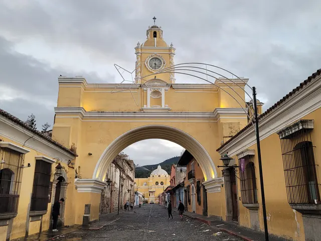
A colonial town of pastel streets below three volcanoes.
Photo: Erik Cleves Kristensen / CC BY 2.0, via Wikimedia Commons licence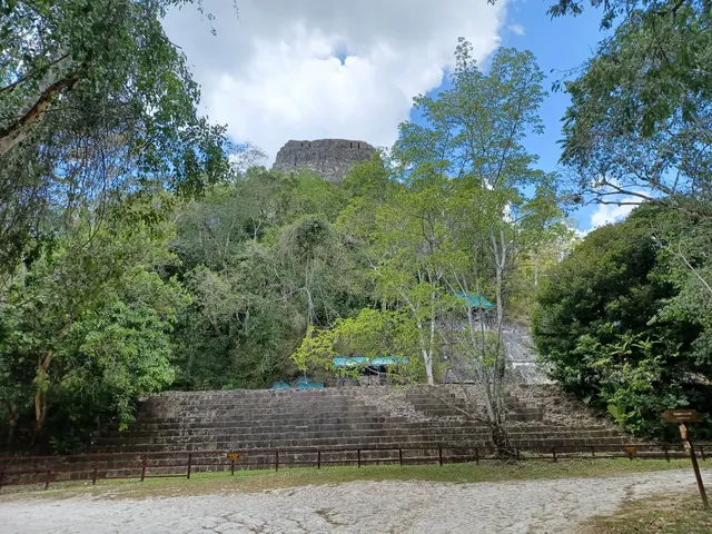
Steep Mayan temple pyramids rising above rainforest canopy.
Photo: Simon Burchell / CC BY-SA 4.0, via Wikimedia Commons licence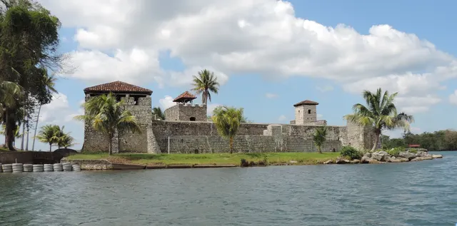
Guatemala's largest lake, with a Spanish fort guarding its outlet to the Caribbean.
Photo: Willyman / CC BY-SA 4.0, via Wikimedia Commons licenceQuestions we ask
2| Question | Answer |
|---|---|
| What currency does Guatemala use? | Quetzal |
| Tikal, a great Maya city in the jungle, is in which country? | Guatemala |
Guatemala, question by question
The flag round shows El Salvador, Nicaragua and Honduras next to Guatemala. The shape question offers Honduras, El Salvador and Mexico. El Salvador and Honduras are on both lists.
Trivia asks: “What currency does Guatemala use?” The answer is Quetzal. It also asks: “Tikal, a great Maya city in the jungle, is in which country?” (Guatemala). Explorer has 3 Guatemala photos: Antigua, Tikal and Lake Izabal.
Every Guatemala question, with streaks and a leaderboard, is in the app.
PlayQuestions and answers
What is the capital of Guatemala?
The capital of Guatemala is Guatemala City.
Which continent is Guatemala in?
Guatemala is in the Americas.
What is the population of Guatemala?
About 18 million (2024 estimate).
Which countries border Guatemala?
Guatemala borders Mexico, Belize, Honduras and El Salvador.
What is the highest point in Guatemala?
Volcan Tajumulco, at 4,220 m.
What is the official language of Guatemala?
Spanish.