
Country quiz · The Americas
Mexico quiz
Mexico is in our flag, outline, map, trivia and numbers rounds, and 21 Explorer photos. Both the flag and the outline are shown beside South American countries, and that is where the wrong answers go.
★ 4.7 on Google Play· 60 ratings· 1000+ downloads· Free
8 questions about Mexico only, mixed from every pack it appears in. Scored on the spot.
Mexico at a glance
| Capital | Mexico City |
|---|---|
| Continent | The Americas |
| Location | North America, bordering the Caribbean Sea and the Gulf of America, between Belize and the United States and bordering the North Pacific Ocean, between Guatemala and the United States |
| Population | 131 million (2024 estimate), 10th of 196 |
| Area | 1,964,375 km², 13th of 196 |
| People per km² | 67 |
| Land borders | United States (3,155 km), Guatemala (958 km), Belize (276 km) |
| Coastline | 9,330 km |
| Highest point | Volcan Pico de Orizaba, 5,636 m |
| Lowest point | Laguna Salada, -10 m |
| Official languages | Spanish, Nahuatl and Yucatec Maya |
| Currency | peso |
| Flag colours | green, white and red |
| Drives on the | right |
| Calling code | +52 |
| Largest cities | Mexico City (22 million), Guadalajara (5.4 million), Monterrey (5.1 million), Puebla (3.3 million) |
| Terrain | High, rugged mountains; low coastal plains; high plateaus; desert |
| Climate | Varies from tropical to desert |
| Where the name comes from | Name may derive from one of the Nahuatl (Aztec) names for the capital city, Metztlixihtlico, which probably meant "the center of the moon;" alternatively, it may come from Mexica, the original name of the Aztec people |
| In our quizzes | 7 packs |
Of 3 land neighbours, the United States shares the longest border with Mexico (3,155 km) and Belize the shortest (276 km); there are also 9,330 km of coast. By area Mexico is 13th of 196 countries, just behind Saudi Arabia and ahead of Indonesia. Volcan Pico de Orizaba rises to 5,636 m; only 19 countries reach higher. The lowest point, Laguna Salada, lies 10 m below sea level.
Facts from the CIA World Factbook and Wikidata; questions from our quiz packs. Updated .
Where it is
Places to find
21 in Explorer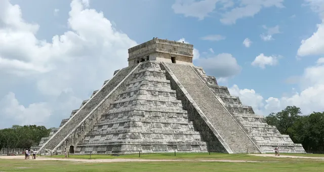
The stepped Maya pyramid of Kukulcán on the Yucatán plain.
Photo: Daniel Schwen / CC BY-SA 4.0, via Wikimedia Commons licence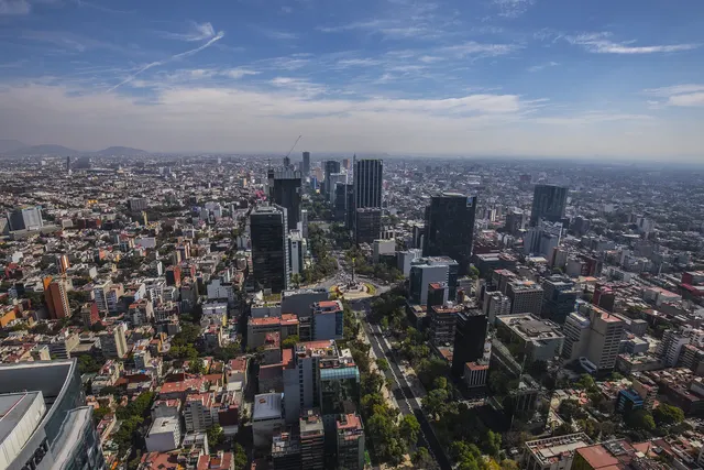
One of the largest cities in the world, built on the drained lake of the Aztec capital.
Photo: Gobierno CDMX / CC0, via Wikimedia Commons licence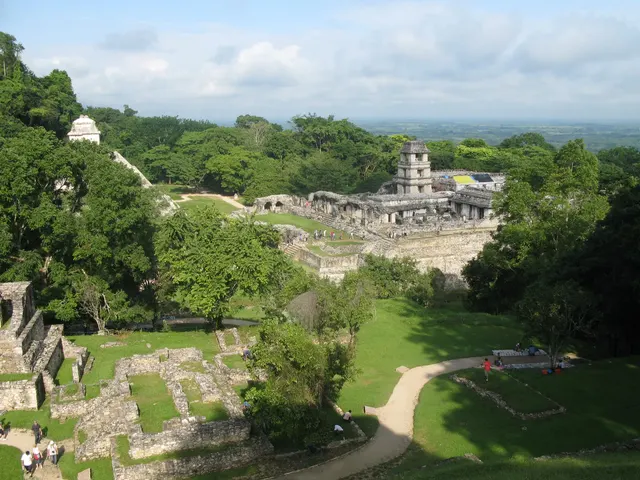
A Maya city in the Chiapas jungle with a palace tower and a royal tomb.
Photo: Ljuba brank at Slovenian Wikipedia / CC BY-SA 3.0, via Wikimedia Commons licence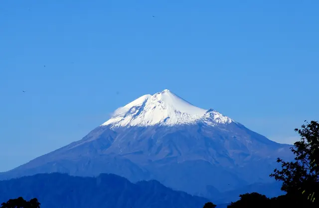
Pico de Orizaba, Mexico's highest peak, a 5,636-metre volcano.
Photo: dinesh rao / CC BY 2.0, via Wikimedia Commons licence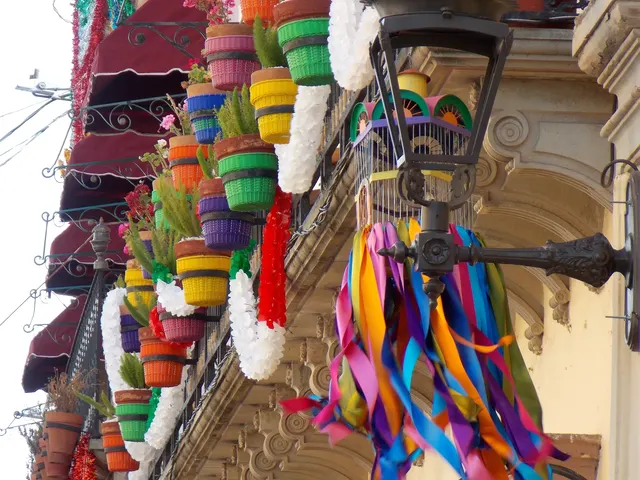
A silver-mining city of rainbow houses stacked in a ravine.
Photo: Maria Cv99 / CC BY-SA 4.0, via Wikimedia Commons licence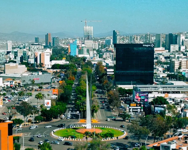
The busiest land border crossing in the world, on the edge of San Diego.
Photo: Urbaner44 / CC BY-SA 4.0, via Wikimedia Commons licenceAll 21 Mexico photos in Explorer →
Questions we ask
11| Question | Answer |
|---|---|
| What currency does Mexico use? | Peso |
| Which country has the most native Spanish speakers? | Mexico |
| Which river forms much of the border between the United States and Mexico? | Rio Grande |
| Which is the highest mountain in Mexico? | Pico de Orizaba |
| Which mountain range runs down western North America from Canada to New Mexico? | Rocky Mountains |
| How many states does Mexico have? | 31 |
| Which of these countries does NOT use a currency called the dollar? | Mexico |
| In which country is Chichén Itzá? | Mexico |
| What is the population of Mexico? (millions) | 130 million |
| In what year did Mexico gain independence from Spain? | 1821 |
| What is the area of Mexico? (in thousand km²) | 1,964 thousand km² |
Facts from our quizzes
What people get wrong about Mexico
The flag question offers Argentina, Peru and Bolivia. Peru is the near miss: red, white, red vertical with arms in the middle, the same layout as Mexico's green, white, red with the eagle. Bolivia is red, yellow, green horizontal; Argentina is blue and white with a sun. Green at the hoist means Mexico. The outline is shown beside Colombia, Venezuela and Peru. Mexico is the one with the Baja peninsula hanging down the west side and the Yucatán sticking out to the east. None of the other three have either.
There is no capital question for Mexico in the capitals rounds. Trivia covers the country another way, asking which of Spain, Colombia, Mexico and Argentina has the most native Spanish speakers. Mexico is the answer. Trivia also asks for the currency, the Mexican peso. In numbers we hold the population, 130 million, the area, 1,964 thousand square kilometres, and independence from Spain in 1821. Explorer marks Chichén Itzá, Palenque, Mexico City and Citlaltepetl easy. Teotihuacán, Tulum, San Miguel de Allende and Santiago de Querétaro are marked hard.
Every Mexico question, with streaks and a leaderboard, is in the app.
PlayQuestions and answers
What is the capital of Mexico?
The capital of Mexico is Mexico City.
Which continent is Mexico in?
Mexico is in the Americas.
What is the population of Mexico?
About 131 million (2024 estimate).
Which countries border Mexico?
Mexico borders the United States, Guatemala and Belize.
What is the highest point in Mexico?
Volcan Pico de Orizaba, at 5,636 m.
What is the official language of Mexico?
There are 3: Spanish, Nahuatl and Yucatec Maya.