
Country quiz · Europe
Hungary quiz
Hungary shows up in 7 quizzes: 5 Explorer photos, the Europe map, capital, flag, 3 trivia questions and outline. Hungarian Parliament and Hollókő are among its 5 photos.
★ 4.7 on Google Play· 60 ratings· 1000+ downloads· Free
8 questions about Hungary only, mixed from every pack it appears in. Scored on the spot.
Hungary at a glance
| Capital | Budapest |
|---|---|
| Continent | Europe |
| Location | Central Europe, northwest of Romania |
| Population | 9.9 million (2024 estimate), 95th of 196 |
| Area | 93,028 km², 106th of 196 |
| People per km² | 106 |
| Land borders | Slovakia (627 km), Romania (424 km), Croatia (348 km), Austria (321 km), Serbia (164 km), Ukraine (128 km), Slovenia (94 km) |
| Coastline | None, landlocked |
| Highest point | Kekes, 1,014 m |
| Official language | Hungarian |
| Currency | forint |
| Flag colours | red, white and green |
| Drives on the | right |
| Calling code | +36 |
| Terrain | Mostly flat to rolling plains; hills and low mountains on the Slovakian border |
| Climate | Temperate; cold, cloudy, humid winters; warm summers |
| Where the name comes from | The Byzantine Greeks referred to the tribes that arrived on the steppes of Eastern Europe in the 9th century as the "Oungroi," a name that later became "Hungari," which originally meant an "[alliance of] ten tribes;" the Hungarian name Magyarorszag means "Country of the Magyars," which may be derived from the name of the most prominent of the Hungarian tribes |
| In our quizzes | 7 packs |
Hungary is landlocked and touches 7 countries; Slovakia has the longest border with it (627 km), Slovenia the shortest (94 km). By area Hungary is 106th of 196 countries, just behind South Korea and ahead of Portugal.
Facts from the CIA World Factbook and Wikidata; questions from our quiz packs. Updated .
Where it is
Places to find
5 in Explorer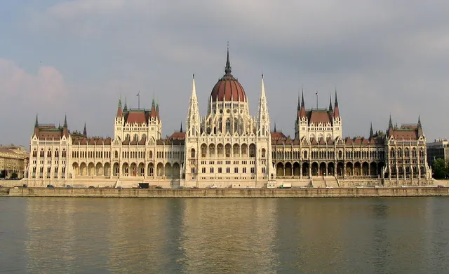
A neo-Gothic riverside parliament on the Danube.
Photo: Dirk Beyer / CC BY-SA 3.0, via Wikimedia Commons licence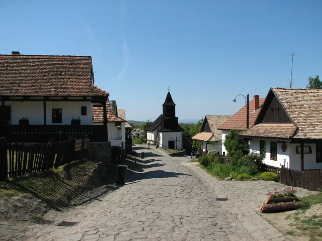
A preserved Palóc village of whitewashed wooden houses in northern Hungary.
Photo: Krzyżówki / CC BY 3.0, via Wikimedia Commons licence
Hungary's industrial city in the Bükk hills, with a medieval castle at Diósgyőr.
Photo: Explicatory / CC0, via Wikimedia Commons licence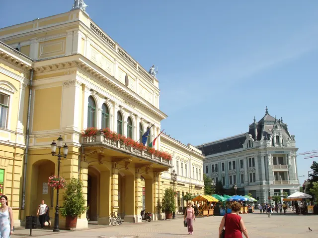
A city of the Great Hungarian Plain, with an Art Nouveau county hall.
Photo: Public domain, via Wikimedia Commons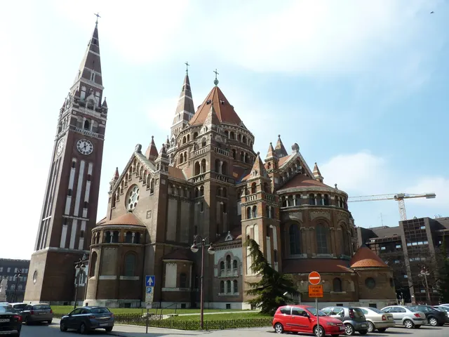
Hungary's sunniest city, rebuilt in grand style after the 1879 flood.
Photo: V.Mariann / CC BY-SA 3.0, via Wikimedia Commons licenceQuestions we ask
5| Question | Answer |
|---|---|
| Which country's capital is Budapest? | Hungary |
| Which European nation's capital sits on the banks of the Danube river and was formed by merging three towns? | Hungary |
| Which capital on the Danube borders both Austria and Hungary? | Bratislava |
| In which country is Lake Balaton? | Hungary |
| What currency does Hungary use? | Forint |
The Hungary questions
Czechia is a wrong choice for Budapest and again for Hungary's outline. In the flag round the other choices are Italy, Bulgaria and Iran. The shape question offers Austria, Czechia and Slovakia.
One trivia question is “Which capital on the Danube borders both Austria and Hungary?” (Bratislava). Then: “In which country is Lake Balaton?” (Hungary). Explorer pins 5 photos in Hungary; Miskolc and Nyíregyháza are marked hard.
Every Hungary question, with streaks and a leaderboard, is in the app.
PlayQuestions and answers
What is the capital of Hungary?
The capital of Hungary is Budapest.
Which continent is Hungary in?
Hungary is in Europe.
What is the population of Hungary?
About 9.9 million (2024 estimate).
Which countries border Hungary?
Hungary borders Slovakia, Romania, Croatia, Austria, Serbia, Ukraine and Slovenia.
What is the highest point in Hungary?
Kekes, at 1,014 m.
What is the official language of Hungary?
Hungarian.