
Country quiz · Asia
Tajikistan quiz
Tajikistan shows up in 6 quizzes: the Asia map, capital, flag, 3 Explorer photos and 2 trivia questions. Dushanbe is the capital.
★ 4.7 on Google Play· 60 ratings· 1000+ downloads· Free
8 questions about Tajikistan only, mixed from every pack it appears in. Scored on the spot.
Tajikistan at a glance
| Capital | Dushanbe |
|---|---|
| Continent | Asia |
| Location | Central Asia, west of China, south of Kyrgyzstan |
| Population | 11 million (2025 estimate), 89th of 196 |
| Area | 144,100 km², 92nd of 196 |
| People per km² | 74 |
| Land borders | Afghanistan (1,357 km), Uzbekistan (1,312 km), Kyrgyzstan (984 km), China (477 km) |
| Coastline | None, landlocked |
| Highest point | Qullai Somoniyon, 7,495 m |
| Official language | Tajik |
| Currency | Tajikistani somoni |
| Flag colours | red, white, green and gold |
| Independence | 1991, from the Soviet Union |
| Drives on the | right |
| Calling code | +992 |
| Terrain | Mountainous region dominated by the Alay Mountains in the north and the Pamirs in the southeast; western Fergana Valley in north, Kofirnihon and Vakhsh Valleys in southwest |
| Climate | Mid-latitude continental, hot summers, mild winters; semiarid to polar in Pamir Mountains |
| Where the name comes from | The Persian suffix -ostan means "land," so the country name means "Land of the Tajik [people];" the name Tajik comes from the Sanskrit tajika, a name originally used to distinguish Arabs from Turks and derived from the Tay, an Arab people |
| In our quizzes | 6 packs |
Tajikistan is landlocked and touches 4 countries; Afghanistan has the longest border with it (1,357 km), China the shortest (477 km). By area Tajikistan is 92nd of 196 countries, just behind Nepal and ahead of Greece. Qullai Somoniyon rises to 7,495 m; only 5 countries reach higher.
Facts from the CIA World Factbook and Wikidata; questions from our quiz packs. Updated .
Where it is
Places to find
3 in Explorer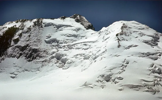
The highest peak of the Pamirs at 7,495 metres, once called Communism Peak.
Photo: Jaan Künnap / CC BY-SA 4.0, via Wikimedia Commons licence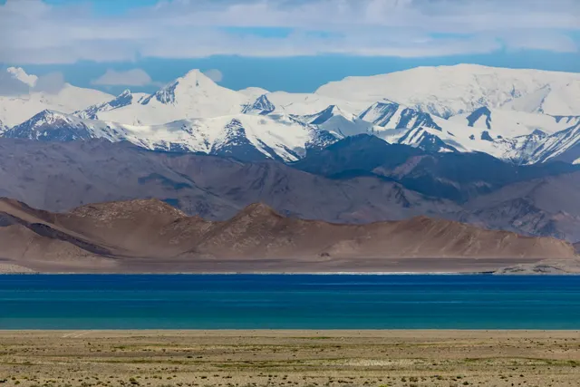
A lake at 3,900 metres in the Pamirs, lying in an ancient meteorite crater.
Photo: Ninara from Helsinki, Finland / CC BY 2.0, via Wikimedia Commons licence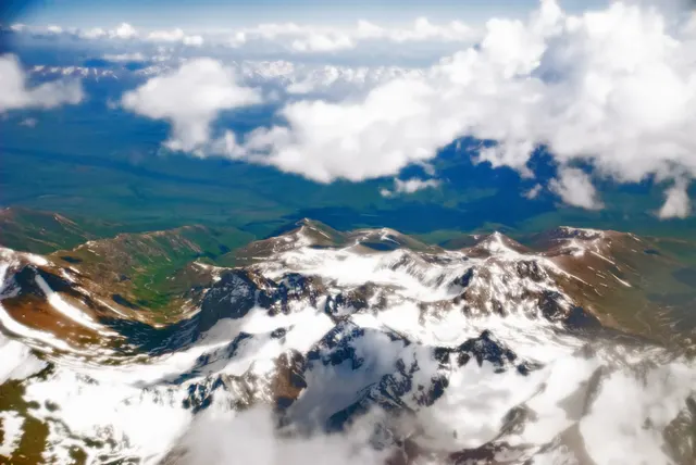
The 'Roof of the World', high glaciers and lakes where the great Asian ranges meet.
Photo: Irene2005 / CC BY 2.0, via Wikimedia Commons licenceQuestions we ask
3| Question | Answer |
|---|---|
| Which country's capital is Dushanbe? | Tajikistan |
| Which is the highest mountain in Tajikistan, once called Communism Peak? | Ismoil Somoni Peak |
| What currency does Tajikistan use? | Somoni |
The Tajikistan questions
Kyrgyzstan is a wrong choice for Dushanbe and again for Tajikistan's flag. In the flag round the other choices are Iran, Kyrgyzstan and Uzbekistan.
One trivia question is “Which is the highest mountain in Tajikistan, once called Communism Peak?” (Ismoil Somoni Peak). Then: “What currency does Tajikistan use?” (Somoni). Explorer has 3 Tajikistan photos: Ismoil Somoni Peak, Karakul and Pamir National Park.
Every Tajikistan question, with streaks and a leaderboard, is in the app.
PlayQuestions and answers
What is the capital of Tajikistan?
The capital of Tajikistan is Dushanbe.
Which continent is Tajikistan in?
Tajikistan is in Asia.
What is the population of Tajikistan?
About 11 million (2025 estimate).
Which countries border Tajikistan?
Tajikistan borders Afghanistan, Uzbekistan, Kyrgyzstan and China.
What is the highest point in Tajikistan?
Qullai Somoniyon, at 7,495 m.
What is the official language of Tajikistan?
Tajik.