
Country quiz · Asia
Afghanistan quiz
We ask about Afghanistan in 7 quizzes: 5 Explorer photos, capital, 3 trivia questions, the Asia map, flag and outline. Minaret of Jam and Buddhas of Bamiyan are among its 5 photos.
★ 4.7 on Google Play· 60 ratings· 1000+ downloads· Free
8 questions about Afghanistan only, mixed from every pack it appears in. Scored on the spot.
Afghanistan at a glance
| Capital | Kabul |
|---|---|
| Continent | Asia |
| Location | Southern Asia, north and west of Pakistan, east of Iran |
| Population | 49 million (2025 estimate), 32nd of 196 |
| Area | 652,230 km², 39th of 196 |
| People per km² | 76 |
| Land borders | Pakistan (2,670 km), Tajikistan (1,357 km), Iran (921 km), Turkmenistan (804 km), Uzbekistan (144 km), China (91 km) |
| Coastline | None, landlocked |
| Highest point | Noshak, 7,492 m |
| Currency | afghani |
| Flag colours | black, red, green and white |
| Drives on the | right |
| Calling code | +93 |
| Terrain | Mostly rugged mountains; plains in north and southwest |
| Climate | Arid to semiarid; cold winters and hot summers |
| Where the name comes from | The name "Afghan" originally referred to the Pashtun people, but today it is understood to include all the country's ethnic groups; the suffix "-stan" means "place of" or "country," so Afghanistan literally means the "Land of the Afghans" |
| In our quizzes | 7 packs |
Afghanistan is landlocked and touches 6 countries; Pakistan has the longest border with it (2,670 km), China the shortest (91 km). By area Afghanistan is 39th of 196 countries, just behind Myanmar and ahead of South Sudan. Noshak rises to 7,492 m; only 6 countries reach higher.
Facts from the CIA World Factbook and Wikidata; questions from our quiz packs. Updated .
Where it is
Places to find
5 in Explorer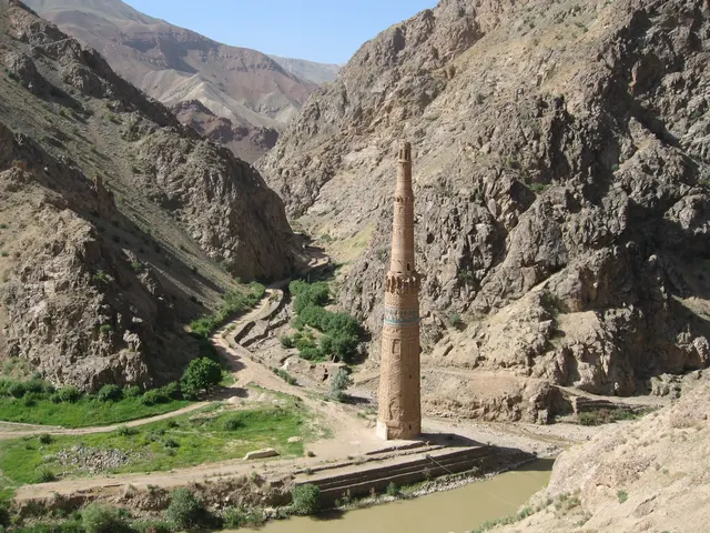
A 65-metre brick minaret standing alone in a remote river gorge.
Photo: AhmadElhan / CC BY-SA 4.0, via Wikimedia Commons licence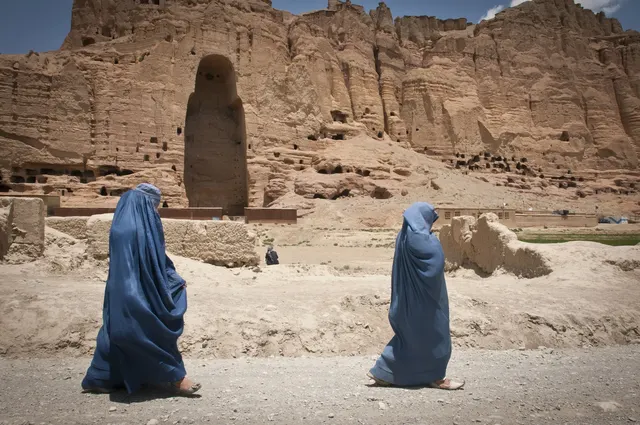
The cliff niches where two giant 6th-century Buddhas stood until 2001.
Photo: Public domain, via Wikimedia Commons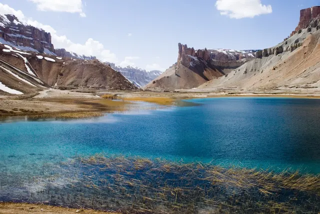
Six deep-blue lakes held back by natural travertine dams in the Hindu Kush.
Photo: Afghanistan Matters from Brunssum, Netherlands / CC BY 2.0, via Wikimedia Commons licence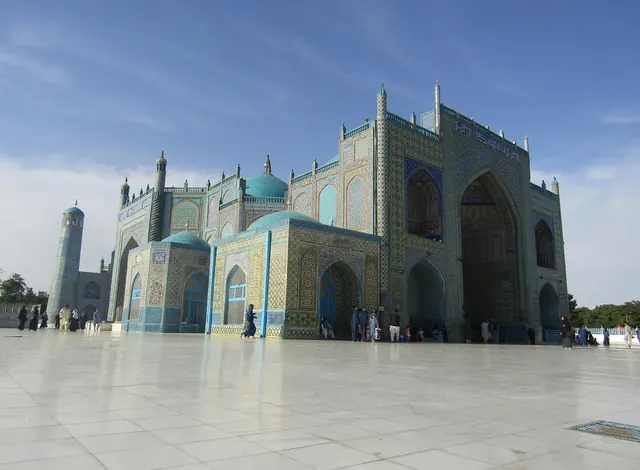
The city of the Blue Mosque, shrine of Ali, covered in turquoise tiles.
Photo: AhmadElhan / CC BY-SA 4.0, via Wikimedia Commons licence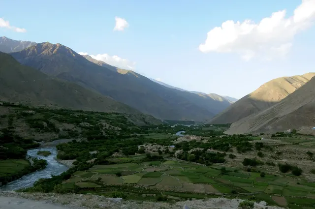
A river valley in the Hindu Kush that resisted the Soviets and the Taliban.
Photo: Master Sgt. Michael O'Connor (U.S. armed forces) / CC BY 2.0, via Wikimedia Commons licenceQuestions we ask
4| Question | Answer |
|---|---|
| Which country's capital is Kabul? | Afghanistan |
| Which mountain pass links Pakistan and Afghanistan? | Khyber Pass |
| Afghanistan’s narrow Wakhan Corridor leads to a short border with which country? | China |
| In Afghanistan, Pashto and which other language are official? | Dari |
Afghanistan in our quizzes
Iran is a wrong choice for Kabul and again for Afghanistan's flag and outline. Iran, Pakistan and Tajikistan sit beside Afghanistan in the flag round. Pakistan, Iran and Tajikistan again for the outline.
Trivia asks: “Which mountain pass links Pakistan and Afghanistan?” The answer is Khyber Pass. It also asks: “Afghanistan’s narrow Wakhan Corridor leads to a short border with which country?” (China). Minaret of Jam and Buddhas of Bamiyan, two of 5 Afghanistan photos, are marked easy; Mazar-i-Sharif is marked hard.
Every Afghanistan question, with streaks and a leaderboard, is in the app.
PlayQuestions and answers
What is the capital of Afghanistan?
The capital of Afghanistan is Kabul.
Which continent is Afghanistan in?
Afghanistan is in Asia.
What is the population of Afghanistan?
About 49 million (2025 estimate).
Which countries border Afghanistan?
Afghanistan borders Pakistan, Tajikistan, Iran, Turkmenistan, Uzbekistan and China.
What is the highest point in Afghanistan?
Noshak, at 7,492 m.