
Country quiz · Asia
Pakistan quiz
Pakistan comes up in 8 quizzes: 3 numbers, 6 trivia questions, 13 Explorer photos, outline, the Asia map, flag and capital. Nanga Parbat and Terich Mir are among its 13 photos.
★ 4.7 on Google Play· 60 ratings· 1000+ downloads· Free
8 questions about Pakistan only, mixed from every pack it appears in. Scored on the spot.
Pakistan at a glance
| Capital | Islamabad |
|---|---|
| Continent | Asia |
| Location | Southern Asia, bordering the Arabian Sea, between India on the east and Iran and Afghanistan on the west and China in the north |
| Population | 257 million (2025 estimate), 5th of 196 |
| Area | 796,095 km², 33rd of 196 |
| People per km² | 323 |
| Land borders | India (3,190 km), Afghanistan (2,670 km), Iran (959 km), China (438 km) |
| Coastline | 1,046 km |
| Highest point | K2, 8,611 m |
| Official languages | Urdu and English |
| Currency | Pakistani rupee |
| Flag colours | green and white |
| Calling code | +92 |
| Largest cities | Karachi (17 million), Lahore (14 million), Faisalabad (3.7 million), Gujranwala (2.4 million) |
| Terrain | Divided into three major geographic areas: the northern highlands, the Indus River plain in the center and east, and the Balochistan Plateau in the south and west |
| Climate | Mostly hot, dry desert; temperate in northwest; arctic in north |
| Where the name comes from | The name is said to have been proposed in the early 1930s by Muslim students at Cambridge University, created from the initials of Punjab, Afghanistan, and Kashmir; the word pak also means "pure" in Persian or Pashto, and the Persian suffix -stan means "place of" or "country," so Pakistan literally means "Land of the Pure" |
| In our quizzes | 8 packs |
Of 4 land neighbours, India shares the longest border with Pakistan (3,190 km) and China the shortest (438 km); there are also 1,046 km of coast. By area Pakistan is 33rd of 196 countries, just behind Mozambique and ahead of Turkey. K2 rises to 8,611 m; only 2 countries reach higher.
Facts from the CIA World Factbook and Wikidata; questions from our quiz packs. Updated .
Where it is
Places to find
13 in Explorer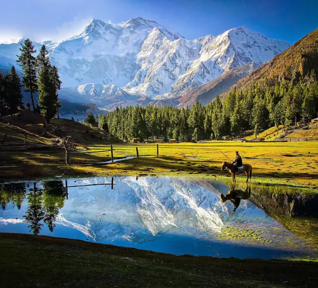
The 'Killer Mountain', ninth highest on Earth, with the largest rock face in the world.
Photo: Tahsin Anwar Ali / CC BY-SA 3.0, via Wikimedia Commons licence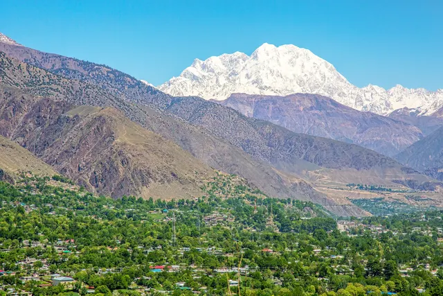
The highest peak of the Hindu Kush, at 7,708 metres.
Photo: Shah Tahsin Anwar / CC BY-SA 4.0, via Wikimedia Commons licence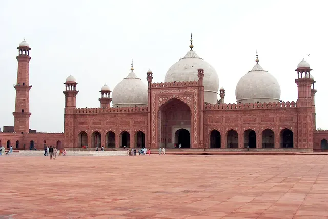
A red-sandstone Mughal mosque from 1673 with one of the largest courtyards on Earth.
Photo: Ali Imran / CC BY-SA 2.5, via Wikimedia Commons licence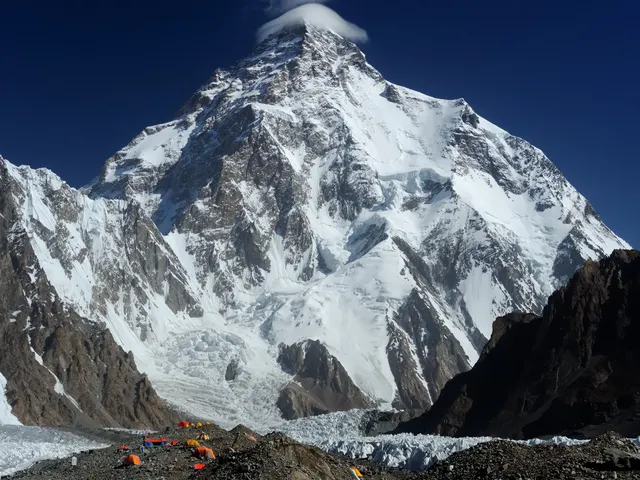
The second highest mountain on Earth and one of the deadliest to climb.
Photo: Zacharie Grossen / CC BY-SA 4.0, via Wikimedia Commons licence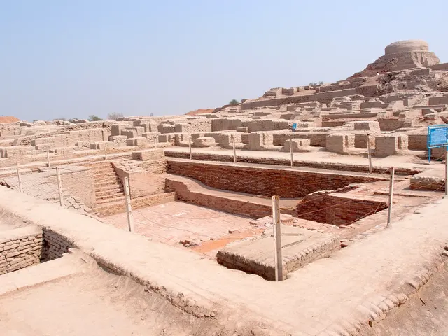
A planned city of the Indus Valley civilisation, 4,500 years old, with brick streets and drains.
Photo: Saqib Qayyum / CC BY-SA 3.0, via Wikimedia Commons licence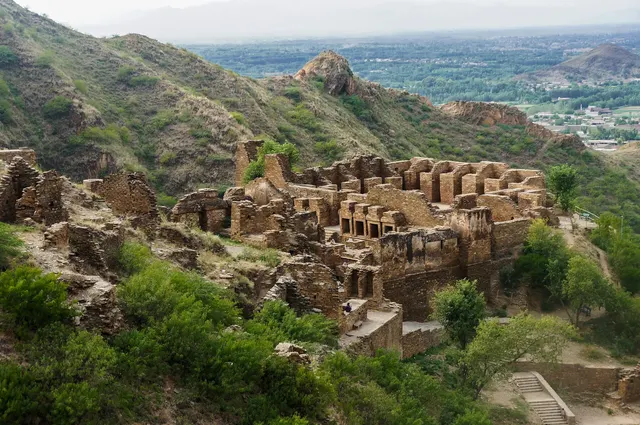
The ruins of a Buddhist monastery on a hilltop, over 2,000 years old.
Photo: Asif Nawaz / CC BY-SA 3.0, via Wikimedia Commons licenceAll 13 Pakistan photos in Explorer →
Questions we ask
10| Question | Answer |
|---|---|
| Which country's capital is Islamabad? | Pakistan |
| Which is the official language of Pakistan? | Urdu |
| Which is the longest river in Pakistan? | Indus |
| Which mountain pass links Pakistan and Afghanistan? | Khyber Pass |
| Which city was built in the 1960s to become Pakistan’s capital? | Islamabad |
| What currency does Pakistan use? | Rupee |
| Which country’s name means “land of the pure”? | Pakistan |
| What is the population of Pakistan? (millions) | 255 million |
| In what year did Pakistan gain independence? | 1947 |
| What is the area of Pakistan? (in thousand km²) | 881 thousand km² |
Facts from our quizzes
Pakistan in our quizzes
India is a wrong choice for Islamabad and again for Pakistan's flag and outline. Afghanistan, Bangladesh and India sit beside Pakistan in the flag round. The shape question offers Afghanistan, India and Iran. Afghanistan and India are on both lists.
Trivia asks: “Which is the official language of Pakistan?” The answer is Urdu. It also asks: “Which is the longest river in Pakistan?” (Indus). In numbers we hold a population of 255 million, independence in 1947 and an area of 881 thousand square kilometres. Nanga Parbat and Terich Mir, two of 13 Pakistan photos, are marked easy; Hunza Valley is marked hard.
Every Pakistan question, with streaks and a leaderboard, is in the app.
PlayQuestions and answers
What is the capital of Pakistan?
The capital of Pakistan is Islamabad.
Which continent is Pakistan in?
Pakistan is in Asia.
What is the population of Pakistan?
About 257 million (2025 estimate).
Which countries border Pakistan?
Pakistan borders India, Afghanistan, Iran and China.
What is the highest point in Pakistan?
K2, at 8,611 m.
What is the official language of Pakistan?
There are 2: Urdu and English.