
Country quiz · Asia
Iran quiz
Iran shows up in 8 quizzes: 2 numbers, outline, flag, capital, 5 trivia questions, the Asia map and 13 Explorer photos. Tehran is the capital.
★ 4.7 on Google Play· 60 ratings· 1000+ downloads· Free
8 questions about Iran only, mixed from every pack it appears in. Scored on the spot.
Iran at a glance
| Capital | Tehran |
|---|---|
| Continent | Asia |
| Location | Middle East, bordering the Gulf of Oman, the Persian Gulf, and the Caspian Sea, between Iraq and Pakistan |
| Population | 89 million (2025 estimate), 17th of 196 |
| Area | 1,648,195 km², 17th of 196 |
| People per km² | 54 |
| Land borders | Iraq (1,599 km), Turkmenistan (1,148 km), Pakistan (959 km), Afghanistan (921 km), Azerbaijan (689 km), Turkey (534 km), Armenia (44 km) |
| Coastline | 2,440 km |
| Highest point | Kuh-e Damavand, 5,625 m |
| Lowest point | Caspian Sea, -28 m |
| Official language | Persian |
| Currency | Iranian rial |
| Flag colours | green, white and red |
| Drives on the | right |
| Calling code | +98 |
| Largest cities | Tehran (9.5 million), Mashhad (3.4 million), Esfahan (2.3 million), Shiraz (1.7 million) |
| Terrain | Rugged, mountainous rim; high, central basin with deserts, mountains; small, discontinuous plains along both coasts |
| Climate | Mostly arid or semiarid, subtropical along Caspian coast |
| Where the name comes from | The name derives from the Sanskrit word arya, referring to people living in a mountainous land, from the root word ar-, or "mountain;" the former name, Persia, was originally "Pars" (or the Arabic-influenced variant "Fars") from the Old Persian parsi, meaning "pure" |
| In our quizzes | 8 packs |
Of 7 land neighbours, Iraq shares the longest border with Iran (1,599 km) and Armenia the shortest (44 km); there are also 2,440 km of coast. By area Iran is 17th of 196 countries, just behind Libya and ahead of Mongolia. Kuh-e Damavand rises to 5,625 m; only 20 countries reach higher. The lowest point, Caspian Sea, lies 28 m below sea level.
Facts from the CIA World Factbook and Wikidata; questions from our quiz packs. Updated .
Where it is
Places to find
13 in Explorer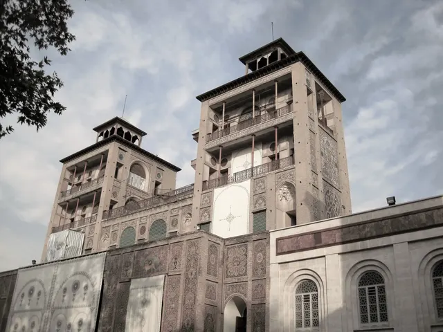
The tiled Qajar royal palace of Tehran, where the last shah was crowned.
Photo: Miladpoorali / CC BY-SA 4.0, via Wikimedia Commons licence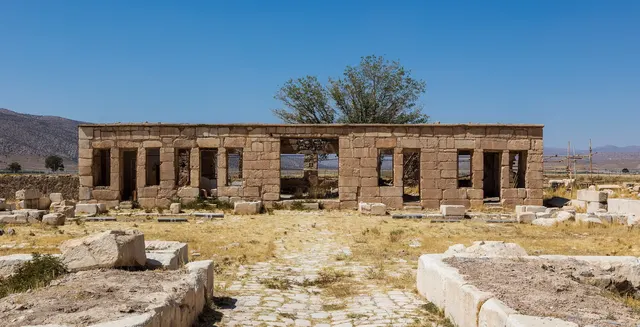
The first Persian capital, with the simple stone tomb of Cyrus the Great.
Photo: Diego Delso / CC BY-SA 4.0, via Wikimedia Commons licence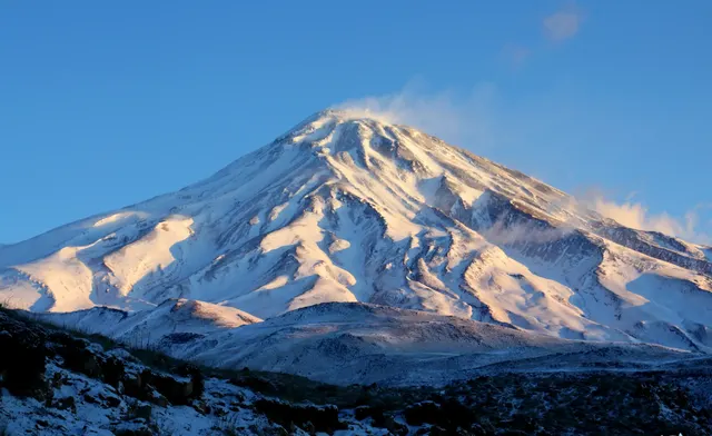
Iran's highest peak, a snow-capped volcano of Persian legend.
Photo: Safa.daneshvar / CC BY-SA 4.0, via Wikimedia Commons licence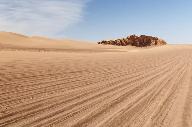
A salt desert that holds the record for the hottest ground temperature on Earth.
Photo: Lrkrol / CC BY 4.0, via Wikimedia Commons licence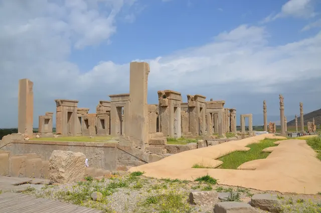
The ceremonial capital of the ancient Persian Empire.
Photo: Carole Raddato / CC BY-SA 2.0, via Wikimedia Commons licence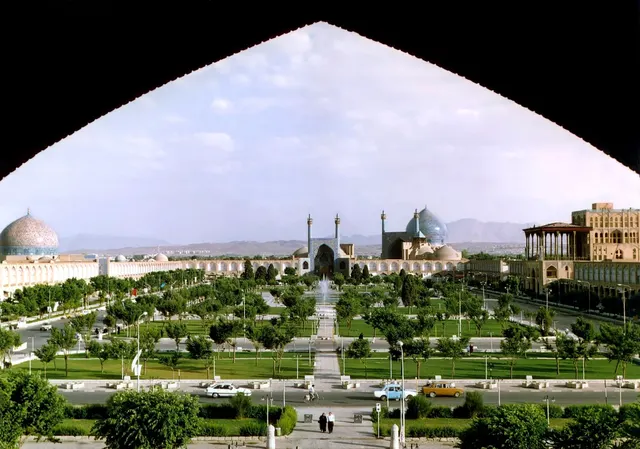
A vast square framed by blue-tiled mosques and bazaars.
Photo: en:User:Arad / CC BY-SA 3.0, via Wikimedia Commons licenceAll 13 Iran photos in Explorer →
Questions we ask
8| Question | Answer |
|---|---|
| Which country's capital is Tehran? | Iran |
| What is the official language of Iran? | Persian (Farsi) |
| Which large lake in Iran has shrunk sharply since the 1990s? | Lake Urmia |
| Which country was called Persia until 1935? | Iran |
| What currency does Iran use? | Rial |
| Persepolis, a capital of the ancient Persian Empire, is in which country? | Iran |
| What is the population of Iran? (millions) | 90 million |
| What is the area of Iran? (in thousand km²) | 1,648 thousand km² |
Facts from our quizzes
The Iran questions
Iraq is a wrong choice for Tehran and again for Iran's flag and outline. In the flag round the other choices are Tajikistan, Iraq and Afghanistan. Iran's shape is shown beside Iraq, Pakistan and Afghanistan. Iraq and Afghanistan are on both lists.
One trivia question is “What is the official language of Iran?” (Persian (Farsi)). Then: “Which large lake in Iran has shrunk sharply since the 1990s?” (Lake Urmia). Iran in numbers: a population of 90 million and an area of 1,648 thousand square kilometres. Golestan Palace and Pasargadae, two of 13 Iran photos, are marked easy; Goharshad Mosque is marked hard.
Every Iran question, with streaks and a leaderboard, is in the app.
PlayQuestions and answers
What is the capital of Iran?
The capital of Iran is Tehran.
Which continent is Iran in?
Iran is in Asia.
What is the population of Iran?
About 89 million (2025 estimate).
Which countries border Iran?
Iran borders Iraq, Turkmenistan, Pakistan, Afghanistan, Azerbaijan, Turkey and Armenia.
What is the highest point in Iran?
Kuh-e Damavand, at 5,625 m.