
Country quiz · Asia
India quiz
India is in every kind of quiz we make and in 30 Explorer photos. Both the flag and the outline are shown beside three neighbours, and Bangladesh is on both lists.
★ 4.7 on Google Play· 60 ratings· 1000+ downloads· Free
8 questions about India only, mixed from every pack it appears in. Scored on the spot.
India at a glance
| Capital | New Delhi |
|---|---|
| Continent | Asia |
| Location | Southern Asia, bordering the Arabian Sea and the Bay of Bengal, between Burma and Pakistan |
| Population | 1,419 million (2025 estimate), 1st of 196 |
| Area | 3,287,263 km², 7th of 196 |
| People per km² | 432 |
| Land borders | Bangladesh (4,142 km), Pakistan (3,190 km), China (2,659 km), Nepal (1,770 km), Myanmar (1,468 km), Bhutan (659 km) |
| Coastline | 7,000 km |
| Highest point | Kanchenjunga, 8,586 m |
| Official languages | Hindi and English |
| Currency | Indian rupee |
| Flag colours | saffron, white, green and blue |
| Independence | 1947, from the United Kingdom |
| Calling code | +91 |
| Largest cities | New Delhi (33 million), Mumbai (21 million), Kolkata (15 million), Bangalore (14 million) |
| Terrain | Upland plain (Deccan Plateau) in south, flat to rolling plain along the Ganges, deserts in west, Himalayas in north |
| Climate | Varies from tropical monsoon in south to temperate in north |
| Where the name comes from | The English name derives from the Indus River; the Indian name, Bharat, may derive from the Bharatas tribe mentioned in the Sanskrit Vedas (Hindu religious texts); the name is also associated with Emperor Bharata, the legendary conqueror of India |
| In our quizzes | 8 packs |
Of 6 land neighbours, Bangladesh shares the longest border with India (4,142 km) and Bhutan the shortest (659 km); there are also 7,000 km of coast. By area India is 7th of 196 countries, just behind Australia and ahead of Argentina. Kanchenjunga rises to 8,586 m; only 3 countries reach higher.
Facts from the CIA World Factbook and Wikidata; questions from our quiz packs. Updated .
Where it is
Places to find
30 in Explorer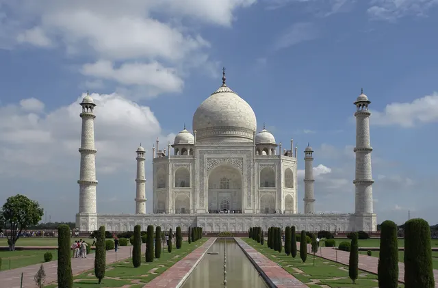
The white marble mausoleum on the Yamuna river, built by Shah Jahan.
Photo: Yann; edited by King of Hearts / CC BY-SA 4.0, via Wikimedia Commons licence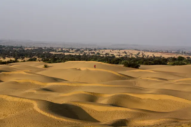
The Great Indian Desert of rolling dunes on the border with Pakistan.
Photo: sushmita balasubramani / CC BY 2.0, via Wikimedia Commons licence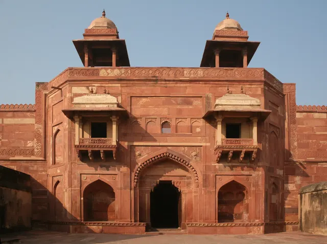
A red-sandstone Mughal capital abandoned only 14 years after it was built.
Photo: Diego Delso / CC BY-SA 4.0, via Wikimedia Commons licence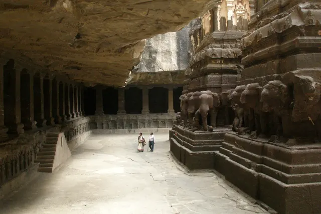
Thirty-four temples carved out of a basalt cliff, including the monolithic Kailasa.
Photo: Vyacheslav Argenberg / CC BY 4.0, via Wikimedia Commons licence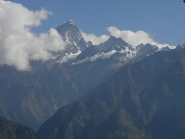
India's highest peak entirely within the country, ringed by a wall of mountains.
Photo: Amir85 / CC BY 2.5, via Wikimedia Commons licence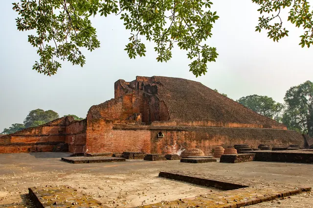
The ruins of a great Buddhist university that taught thousands of students.
Photo: Uphogaphy / CC BY-SA 4.0, via Wikimedia Commons licenceAll 30 India photos in Explorer →
Questions we ask
16| Question | Answer |
|---|---|
| Which country's capital is New Delhi? | India |
| What currency does India use? | Rupee |
| The Taj Mahal is in which country? | India |
| Through which country does the Mekong River NOT flow? | India |
| Which country borders both China and India? | Nepal |
| In which year did India become independent from Britain? | 1947 |
| Who was the first European to reach India by sea, in 1498? | Vasco da Gama |
| How many states does India have? | 28 |
| The Thar Desert lies in India and which other country? | Pakistan |
| In which country is Hindi the most spoken language? | India |
| The Golden Temple, the holiest site of the Sikhs, is in which country? | India |
| In which city is the Gateway of India? | Mumbai |
| The Statue of Unity, the tallest statue in the world, is in which country? | India |
| What is the population of India? (millions) | 1,460 million |
| In what year did India gain independence from Britain? | 1947 |
| What is the area of India? (in thousand km²) | 3,287 thousand km² |
Facts from our quizzes
What people get wrong about India
The flag question offers Sri Lanka, Bangladesh and Nepal. None of them look like India's saffron, white and green with the wheel in the middle, but they are the neighbours, and a rushed thumb picks a neighbour. The outline is shown beside Pakistan, Bangladesh and Sri Lanka. India is the diamond with a long tail down to Kanyakumari; Sri Lanka is the teardrop below it; Bangladesh is the notch cut into the east. The capital question is New Delhi. We ask it twice, and the second version notes the city was planned by the British.
Trivia holds the rupee, the Taj Mahal, and two border questions: which country borders both China and India (Nepal) and which country the Mekong does not flow through (India). In numbers, the population is 1,430 million, the area 3,287 thousand square kilometres, and independence from Britain came in 1947. Explorer has the Taj Mahal, Hampi and the Ellora Caves marked easy. Pangong Lake in Ladakh is marked hard. It also appears on the China page, as Pangong Tso, because the lake crosses the border.
Every India question, with streaks and a leaderboard, is in the app.
PlayQuestions and answers
What is the capital of India?
The capital of India is New Delhi.
Which continent is India in?
India is in Asia.
What is the population of India?
About 1,419 million (2025 estimate).
Which countries border India?
India borders Bangladesh, Pakistan, China, Nepal, Myanmar and Bhutan.
What is the highest point in India?
Kanchenjunga, at 8,586 m.
What is the official language of India?
There are 2: Hindi and English.